4WD Tracks in Canterbury

Canterbury serves up some of the South Island's most varied 4WD tracks, from braided riverbeds and high-country station roads to windswept coastal flats and rugged backcountry passes. Expect wide gravel runs across the plains, rocky river crossings near the foothills, and remote alpine access tracks. It's a region that rewards careful planning and a capable vehicle.

Acheron River Access

Acheron River Access is a short, easy Canterbury high-country spur down to braided river flats, with mountain views and an option to head upstream.

Akaroa Loop

Akaroa Loop is a scenic Banks Peninsula seal-and-gravel drive over big hills, with finger roads dropping to the bays, easy enough for a 2WD ute.

Algidus Road

Algidus Road is an easy Canterbury high-country gravel drive with big views over the braided Rakaia River and an optional drop into the Wilberforce.

Amberley Beach

Amberley Beach is an easy Canterbury coastal run off SH1, with sand driving, river crossings and silty accesses to watch for in poor weather.

Avoca River

The Avoca River track is a hard Canterbury high country run up a braided valley, with deep river crossings and riverbed crawling for capable 4WDs.

Black Forest Station

Black Forest Station is an easy, well-maintained Canterbury 4WD track above Lake Benmore with sweeping Mackenzie Country lake views, by permission for $20.

Black Mountain Hut Access

Black Mountain Hut Access is a Canterbury high-country run from the Havelock River into tussock country near Mesopotamia Station, with big alpine views.

Bossu Road (Birdlings Flat)

Bossu Road at Birdlings Flat is an easy Banks Peninsula gravel climb with big coastal views, the only catch being a loose, soft beach section to start.

Boundary Stream - Lake Access

Boundary Stream Lake Access is a short, easy Mackenzie Country run down to the shores of Lake Tekapo with big views out over the water.

Braemar Road

Braemar Road is an easy Canterbury gravel run through the Mackenzie Country, with turquoise lakes, tussock and big views across to Aoraki.

Cave - Albury

Cave to Albury is a South Canterbury riverbed run with bumpy rock and deep water crossings, best tackled with a snorkel and a lift.

Clarence Reserve

Clarence Reserve is a remote Canterbury high-country 4WD route up the Clarence Valley with steep, rough sections, several fords and big views.

Clarence Reserve (North)

Clarence Reserve North is a remote Canterbury high country run through the Clarence Valley, with fords and big views for capable, well-prepared 4WDs.

Clarence Reserve (South)

Clarence Reserve (South) is a remote Canterbury high-country 4WD route with river fords and big valley views, closed over winter and access by arrangement.

Clarence River Access

Clarence River Access is a short Canterbury detour down to a riverside shelter, an easy side trip with one creek crossing that can get rough.

Clay Cliffs Access

Clay Cliffs Access is a short Canterbury gravel run out to the Omarama Clay Cliffs, a maze of eroded pinnacles and ravines

Clyde River

Clyde River is a remote Canterbury high country route up a braided riverbed, with river crossings, alpine water and access by prior permission only.

Double Hill Run Road

Double Hill Run Road is an easy Canterbury gravel drive up the Rakaia high country, with fords, big central divide views and riverbed access at the end.

Eggleston Road

Eggleston Road is an easy gravel run through the Canterbury hills, with rolling farmland views and handy links to other tracks nearby.

Fanghill

Fanghill is a rocky, slippery medium-grade climb in the Canterbury high country, rewarding the effort with valley views from Fanghill Hut up top.

Glen Lyon Road

Glen Lyon Road is an easygoing Canterbury high country drive along Lake Ohau, with the water in view and big mountain ranges all around.

Godley River

Godley River is a famous Canterbury braided-river run at the head of Lake Tekapo, with shingle flats, many crossings and big high-country views.

Hakataramea Pass

Hakataramea Pass is an easy Canterbury gravel road into the MacKenzie Country, with wide high-country views and a couple of shallow summer fords.

Hakatere Heron Road

Hakatere Heron Road is an easy Canterbury high-country gravel drive to Lake Heron, with tussock basins, braided rivers and the Arrowsmith Range behind.

Hakatere Potts Road

Hakatere Potts Road is a Canterbury high-country gravel run into braided-river country, with big valley views, lakes and a detour to Mt Sunday.

Haldon Arm to lookout - via Iron Bridge

Haldon Arm to lookout via Iron Bridge is a short, easy Canterbury gravel run with lake and dam views and no real river crossings.

Haldon Road

Haldon Road is an easygoing Mackenzie Country gravel run near Twizel, through open tussock to Lake Kenmore with big braided river views.

Hanmer Springs Ski field

Hanmer Springs Ski Field road is a steep, narrow Canterbury climb through beech forest to open tops, with views back over the Hanmer basin.

Harper River

Harper River is an easy Canterbury high country braided river run with several shallow crossings and views of the Pinnacles rock formation.

Harper Road

Harper Road is a long, rough Canterbury gravel road up the western side of Lake Coleridge to a basic alpine campsite, with big lake views the whole way.

Harrisons Bight

Harrisons Bight is an easy permit-required 4WD route through Canterbury high-country tussock to a quiet corner of Lake Heron, with a short walk to the shore.

Havelock Route

The Havelock Route runs up a braided Canterbury river into the central divide, with river crossings, long gravel bed sections and remote alpine valley views.

Hawdon Access Road

Hawdon Access Road is a short high-country run in Canterbury leading to the Hawdon campsite, with braided valleys and big alpine mountain views.

Hawdon River

Hawdon River is a Canterbury high-country route up a braided river bed, with shifting channels and crossings for capable 4WDs comfortable reading rivers.

Haylocks Bay

Haylocks Bay on Banks Peninsula is a short, steep gravel climb from Akaroa to around 780m, with big coastal views and a lighthouse walk.

Hopkins Valley

Hopkins Valley is a classic Canterbury braided-river-bed track running deep into backcountry huts, with deep crossings and a technical section past Red Hut.

Hot Pools Side Route

Hot Pools Side Route is a short Canterbury high country detour leading to natural hot pools, with flat sheltered ground for camping nearby.

Hurunui Bluff

Hurunui Bluff is an easygoing North Canterbury gravel road with river access points, riverside fishing spots and open Hurunui valley views.

Hurunui River

Hurunui River is a short North Canterbury gravel track onto braided shingle flats, popular with anglers chasing trout and salmon.

Hurunui River Access

Hurunui River Access is a short North Canterbury side route down to braided-river flats, handy for a break beside the wide Hurunui.

Intake Road

Intake Road is a short, easy Canterbury high-country gravel climb to a lookout over Lake Coleridge, good for a picnic, swim or a fish.

Jack Pass Road

Jacks Pass Road is an easy graded gravel climb out of Hanmer Springs, Canterbury, and a popular gateway to the Rainbow and Molesworth routes.

Jollies Pass

Jollies Pass is a short, scenic Canterbury gravel climb linking Molesworth and Rainbow country with Hanmer Springs, tame in the dry and an adventure when wet.

Jollies Pass Side Route

Kaitorete Spit

Kaitorete Spit is a flat Canterbury coastal drive on gravel between Lake Ellesmere and the Pacific, with big dune and ocean views.

Kaiwara Road

Kaiwara Road is an easy gravel and farm-track drive through inland Canterbury hill country, with open views and plenty of farm gates along the way.

Klondyke Road

Klondyke Road is a short, easy Canterbury run to riverside campsites, with informal spots away from the crowds and access down to the river bed.

Kowai River

Kowai River is a flexible Canterbury braided-river run from SH1 to the beach, with several crossings and silty accesses best tackled on a fine day.

Kowai River Run

Kowai River Run is a Canterbury river-bed drive with constant shingle crossings, linking the lime works towards the braided Waimakariri valley.

Kowhai Ford

Kowhai Ford is a short, easy braided-river crossing off the highway in Canterbury, a quick taste of off-highway driving with room to explore the flats.

Lake Access

Lake Access is a short, easy gravel run down to the turquoise shores of Lake Tekapo in Canterbury's Mackenzie Country, suited to most vehicles.

Lake Coleridge

Lake Coleridge is a short, easy gravel track in inland Canterbury dropping to the lakeshore with big water and mountain views, plus a long drop at the end.

Lake Emily

Lake Emily is a short but rutted Canterbury high-country 4WD track ending at a quiet lake, suited to capable 4WDs rather than beginners.

Lake Emma

Lake Emma is a short, easy gravel 4WD track in the Canterbury high country with quiet lake views and an old hut you can camp by at the end.

Lake Taylor

Lake Taylor is an easy inland Canterbury gravel drive with crystal-clear lake water, a swing bridge, and views the whole way, fine for 2WD.

Lake Tennyson Campsite access road

Lake Tennyson Campsite access road is a short, corrugated gravel run into an exposed Canterbury high-country lake, best in the snowy colder months.

Lawrence River

Lawrence River is a remote Canterbury braided-river run with open riverbed travel and alpine scenery, needing permission and solid river-driving skills.

Leamington Road

Leamington Road is a winding Canterbury gravel and farm road through rolling foothills, dropping down to the Waiau Uwha River with open country views.

Lees Valley

Lees Valley is an easy Canterbury high-country gravel drive from Christchurch, with working stations, fords, and big views, best in a ute or 4WD.

Loch Katrine

Loch Katrine is an easy Canterbury gravel-and-4WD run past Lake Sumner, good for beginners, with rockier side tracks and a lakeside campsite at the end.

Lookout

Lookout is a short, steep Canterbury high country 4WD climb to a vantage point with wide views over the surrounding valleys.

Lower Acheron Bridge

Lower Acheron Bridge is a quick Canterbury side trip dropping off the main route to a bridge with good views over the Acheron River below.

Lower Farm Stream

Lower Farm Stream is a short, easy-going Canterbury 4WD run that hugs the stream up the valley, shared with walkers and stock.

Lyndon Road

Lyndon Road is a cruisy Canterbury high-country gravel run linking Lake Coleridge with Arthurs Pass, with big lake and saddle views.

Macaulay Valley

Macaulay Valley is a Canterbury braided-river run up to a superb 14-bunk hut, all choose-your-own-line crossings and rock-crawling, best when low.

Mackenzie Pass

Mackenzie Pass is a short, well-maintained Canterbury gravel road linking Fairlie towards Tekapo, with low fords and big mountain views.

Maling Pass

Maling Pass is a moderate Canterbury 4WD route through the St James Conservation Area, with rocky channels, big alpine views and DOC gate access.

Meyers Pass

Meyers Pass is an easy South Canterbury gravel crossing through the Campbell Hills, with a pass near 700 m, an old stone bridge and wallabies about.

Mid Canterbury 4x4 Park

Mid Canterbury 4x4 Park near Ashburton is a very hard 4WD playground with tight bush sections, best tackled with a buddy and proper recovery gear.

Middle Valley Road

Middle Valley Road is an easygoing Canterbury gravel route through rolling hill country, with open farmland and tussock views away from the highways.

Moa Stream

Moa Stream is a braided-river 4WD route in the Canterbury high country with boulders, multiple crossings and pick-your-own-line driving out to Moa Hut.

Molesworth Station

Molesworth Station is a long high-country gravel road through the Awatere Valley between Blenheim and Hanmer Springs, with big mountain views and easy touring.

Mount White Road

Mount White Road is a Canterbury high-country gravel run along the braided Waimakariri, with big alpine views and the historic one-lane Mount White Bridge.

Mt Aspiring Access Road

Mt Aspiring Access Road is an easy Canterbury gravel run through alpine valleys, with shallow fords and short walks to a waterfall and the Rob Roy Glacier.

Mt Cheeseman

Mt Cheeseman is a steep, narrow Canterbury gravel climb up the Craigieburn Range, from beech forest to alpine tussock with big tops views.

Mt Cook photo spot

Mt Cook photo spot is a short Canterbury high-country gravel pull-off where you can frame your 4WD against Aoraki/Mt Cook on a clear day.

Mt Studholme

Mt Studholme is a short, steep South Canterbury 4WD climb to 1086m with big summit views over farmland, the ranges and the Southern Alps.

Napenape Beach

Napenape Beach is a rare drive-on coastal run in North Canterbury, a short sandy hop along a wild, exposed shoreline with open sea views.

Napenape Road

Napenape Road is an easygoing Canterbury gravel road running out to a rugged coastline at Napenape Beach, suited to most vehicles.

Natural Hot Pools

Natural Hot Pools is a short, challenging Canterbury side track off the Scotties Hut road, dropping to warm bush-clad pools with room for a few tents.

Ohau C

Ohau C is a short Canterbury river-braid run through the Pukaiki River, a handy Lyndon Road shortcut towards the Omarama Saddle, with difficulty set by river flow.

Ohau Ski Field road

Ohau Ski Field road is a steep, unsealed Mackenzie Country climb into the Ben Ohau Range, with big tussock high-country and basin views.

Okuku River

Okuku River is a short, rugged Canterbury 4WD run through braided river country with repeated crossings that shift with the river and reward careful line choice.

Old Le Bons Track

Old Le Bons Track is a steep, rutted Banks Peninsula climb through private land near Le Bons Bay, with big peninsula views and a winch-worthy rock step.

Paddle Hill Creek

Paddle Hill Creek is a short medium-grade side track off Hakatere Heron Road in Canterbury's high country, running out through tussock to the creek.

Palmer Road

Palmer Road is a scenic Canterbury gravel run along the Upper Grey River, with easy going and valley views between the alpine and West Coast country.

Puhi Puhi Valley

Puhi Puhi Valley is an easy gravel drive north of Kaikoura, following the river through bush with small fords and a roadside DOC campsite.

Pukaki River

Pukaki River is a long, bumpy but easy Mackenzie Country gravel track with high-country scenery, an old iron bridge and salmon in the river.

Pylon Lookout

Pylon Lookout is a short, steep Canterbury climb up to a pylon above the St James high country, with wide views and a tricky descent back down.

Quailburn Road/Historic site

Quailburn Road is an easy Mackenzie gravel road near Omarama, leading through tussock high country to a historic woolshed and old station stockyards.

Rainbow Road

Rainbow Road is a long Canterbury backcountry gravel run with optional river fords, alpine scenery and great camping near Lake Tennyson.

Rakaia valley

Rakaia Valley is a hard braided-river 4WD route through Canterbury's high country, with constant crossings, soft channels and big alpine scenery.

Random Spur Road

Random Spur Road is a rugged North Canterbury farm track from Cheviot to Kaiwara Road East, with big views over the Hurunui River and a trig side track.

Rangitata Gorge Road

Rangitata Gorge Road is an easy Canterbury gravel route through braided high country towards the Havelock River, with shallow fords and a winter edge.

River Access

River Access is a short Canterbury easement down to the Ahuriri River, with braided river flats and high country views as you head up the valley.

Scotties Hut/Edwards Valley

Scotties Hut/Edwards Valley is a St James high country drive in Canterbury with sweeping mountain views, small river crossings, and a DOC permit gate.

Side of Lake Tekapo/Lillybank Road

Side of Lake Tekapo/Lillybank Road is an easy, well-graded Canterbury gravel run with turquoise lake and big mountain views, reaching the Godley and Macaulay valleys.

Stock Road

Stock Road is an unsealed Canterbury farm route into Lees Valley, with rolling high-country pasture and easy going for most vehicles.

Te Moana Road

Te Moana Road is an easy Canterbury gravel route following a river up through the hills to a locked gate, with valley views opening out as you climb.

The Arrowsmith 4WD track

The Arrowsmith 4WD track is a seasonal Canterbury high-country loop with shale slips, big valley views and overnight stays at Top Hut by the Ashburton River.

Top House Road

Top House Road is an easy rough-gravel run through the St James Conservation Area, linking Hanmer Springs and Lake Tennyson with bridged crossings and big mountain views.

Waiau River Access

Waiau River Access leads into Canterbury braided-river country, where shifting gravel and channels mean reading the land and picking your own line.

Wilberforce River

Wilberforce River is a braided Canterbury 4WD run deep into the Southern Alps, with shifting crossings, backcountry huts and big alpine scenery.

Wilberforce River (West access)

Wilberforce River west access is a Canterbury high-country braided river run with no fixed track, for drivers confident reading channels and crossings.

Zig Zag Road

Zig Zag Road is an easy Canterbury gravel shortcut that winds up into the hills, with good views over the Rakaia Gorge on the descent.

Tracks in other regions

Get out there and explore more.

Download Overland Navigator free for iPhone or Android and start planning your next 4WD adventure - with New Zealand’s best tracks, campsites, and trips ready to go whenever you are.
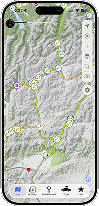
Start Exploring With Overland Navigator