4WD Tracks in West Coast

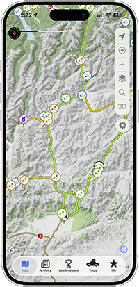
The West Coast packs wild contrast into every kilometre, from rugged surf beaches and braided river crossings to dense rainforest and the steep historic mining country around Denniston. The 4WD tracks here range from coastal access at spots like Gillespies and Hunts Beach to creek-laced backcountry routes, rewarding well-prepared overlanders who respect the region's changeable weather and remote terrain.

Ahaura Kopara Road

Ahaura Kopara Road is an easy West Coast gravel drive through old native forest down to the Ahaura River, where it dead-ends with no crossing.

Ahaura River

Ahaura River is a short, relaxed West Coast braided-river 4WD run with open shingle flats, several access points and easy riverbed exploring.

Beach Access

Beach Access is a short West Coast track that drops you straight onto the sand for a quick taste of coastal driving and open surf views.

Beach Access

Beach Access is a short West Coast route that drops straight onto open sand, handy for reaching the wild shoreline without a long approach.

Beach Road

Beach Road is an easy West Coast gravel run out to a wild, driftwood-strewn shoreline, suited to most vehicles for a quick coastal stop.

Big River

Big River is a long, winding West Coast goldmining track through beech forest, rocky and slow but doable in most stock 4WDs, with a DOC hut up top.

Blackwater Creek

Blackwater Creek is a hard West Coast 4WD track climbing a bush valley with water crossings, mud and tight, overgrown going for capable rigs.

Bold Head Road

Bold Head Road is a short, easy gravel connector on the West Coast, best run together with the local beach for a more interesting drive.

Bullock Creek

Bullock Creek is an easy single-lane gravel road on the West Coast near Punakaiki, heading inland through limestone country to the Cave Creek Memorial walk.

Charming Creek Road

Charming Creek Road is an easy West Coast gravel road north of Westport, running through native bush to the start of the historic Charming Creek Walkway.

Cockeye Creek

Cockeye Creek is a hard technical 4WD route on the West Coast, following the creek bed through remote country, for capable rigs only.

Conns Creek

Conns Creek is an easy West Coast gravel drive near Westport, running up to the historic Denniston railway incline through classic Coast bush.

Denniston (Alternative route)

Denniston Alternative Route is a windswept West Coast 4WD line across the old coal-mining plateau above Westport, with big views and exposed tops.

Denniston 4wd Loop

The Denniston 4wd Loop is a rough 11 km West Coast climb across a windswept coal-mining plateau, with range and coast views for capable 4WDs.

Denniston 4wd Loop Bypass

Denniston 4WD Loop Bypass is a short cut across the historic, windswept Denniston Plateau above Westport, with rugged terrain for capable 4WDs.

Denniston Alternative

Denniston Alternative is a medium-grade West Coast plateau loop running toward the Mackley River end, with a different take on Denniston's coal-mining country.

Denniston Brakehead Access

Denniston Brakehead Access is a short West Coast track to a clifftop viewpoint above the old coal mine, with big ocean views and mining history.

Denniston to New Creek

Denniston to New Creek is a scenic West Coast 4WD route with steep rocky climbs, a 4WD playground at the Denniston end, and the deep Mackley River crossing.

Duffers Creek

Duffers Creek is a West Coast 4WD track following a creek through native bush, with mixed gravel and rocky going for capable, hands-on drivers.

Four Mile Road

Four Mile Road is an easy West Coast gravel drive through limestone-walled bush to the Nile River, suited to relaxed touring rather than technical work.

Garden Creek

Garden Creek is a tight, scratchy West Coast 4WD climb through bush to the historic Garden Creek mine, suited to capable vehicles wanting a low-traffic backcountry run.

Gillespies Beach

Gillespies Beach is an easy West Coast gravel run past Fox Glacier to a wild, driftwood-strewn shore with Southern Alps views inland.

Hochstetter Historic Area access

Hochstetter Historic Area access is a rough West Coast gravel road climbing through working forestry into old gold and coal mining country.

Hochstetter Historic site

Hochstetter Historic Site is a short, easy West Coast 4WD detour leading to a spot of heritage interest, worth a look while exploring the wider area.

Hunts Beach

Hunts Beach is a wild West Coast beach run in South Westland, firm open sand below coastal bush with a soft river crossing to mind heading north.

Hunts Beach Road

Hunts Beach Road is a short West Coast gravel detour climbing through native bush to a wild, remote stretch of open coastline.

Jim's Flat Hut

Jim's Flat Hut is a short, easy West Coast gravel track running through bush to a tidy hut and the Ahaura River, with a cableway at the water's edge.

Kumara Ichbonnie Road

Kumara Ichbonnie Road is an easygoing West Coast gravel run around Lake Brunner's southern side, through old native bush with plenty of scenery.

Lake Ahaura

Lake Ahaura is a remote West Coast 4WD track through dense native bush, easing you in before the going gets tougher toward a quiet backcountry lake.

Lake Hochstetter Access

Lake Hochstetter Access is a rough West Coast gravel and logging road through bush, ending at a quiet lakeside spot favoured by anglers.

Landsborough Valley

Landsborough Valley is a short, scenic West Coast 4WD track climbing to Strutt Bluff, with overgrown scrub, river-bed fords and big views at the far end.

Maori Gully Road

Maori Gully Road is a West Coast forestry link track over the hills, graded medium with gorse-lined going and a few washed-out sections.

Mccullums Mill Road

McCullums Mill Road is an easy West Coast gravel run near Karamea, leading through native bush to the Ōpārara Arches and forest walking tracks.

Mirfin Road

Mirfin Road is a West Coast gravel back road climbing into the eastern Paparoa ranges through green bush-clad hill country, easy going for most vehicles.

Moonlight Creek

Moonlight Creek is a short West Coast side road dropping to the river, a quick out-and-back detour with a possible crossing to assess on the day.

Moonlight Creek

Moonlight Creek is an easy West Coast gravel road through dense native rainforest, following the creek to walking tracks.

Mt Frederick

Mt Frederick is a very difficult West Coast 4WD climb with steep rocky going, a river crossing and remote backcountry scenery for skilled drivers.

Mt Greenland

Mt Greenland is a steep, rugged West Coast 4WD climb behind Ross, with tight gorse, a notorious papa mud hole, and big Tasman Sea views up top.

Mt Rochfort

Mt Rochfort is a rocky West Coast climb up onto the Denniston Plateau, rated easy to medium, with big coastal views and side tracks to explore.

Napoleon Hill

Napoleon Hill is a one-of-a-kind West Coast 4WD track near Ahaura, running through old gold-mining tunnels, gorges and river beds.

Offshoot

Offshoot is a short, optional West Coast detour offering a more technical line off the main track, suited to capable, well-equipped 4WDs.

Owen Valley East

Owen Valley East is an easygoing West Coast gravel road following the Owen River through quiet farmland and hill country, fine for most vehicles.

Paparoa Track Road

Paparoa Track Road is an easy West Coast gravel run through bush-clad hills to the Paparoa Track trailhead, with native forest walks and old coal mine history.

Prohibition Road

Prohibition Road is a West Coast goldfields climb to around 580 metres, passing the country's deepest mineshaft and old ball mill foundations.

Prohibition Road Side Route

Prohibition Road Side Route is a short West Coast detour into bush-clad hill country, a quick scenic side trip rather than a full day's drive.

Reefton Lookout

Reefton Lookout is a short, easy gravel climb above the old West Coast gold-mining town, with bush-clad hill views from the top.

Slab Hut Creek Access

Slab Hut Creek Access is a short, easy West Coast gravel road into a quiet creekside campsite, with a small ford beside the bridge on the way in.

Soldiers Road

Soldiers Road is a scenic West Coast gravel road following Devils Creek through thick bush up to the start of the Big River track.

Taramakau River Access

Taramakau River Access on the West Coast drops onto a braided gravel riverbed with open shingle, shifting channels, and big swings in water levels.

The lookout

The Lookout is a popular West Coast gravel track climbing onto a plateau with far-reaching views and an unguarded cliff edge at the top.

Totora Valley

Totora Valley is an easy West Coast gravel road through native bush, finishing on the Mikonui River, with creek turn-offs and a few narrow sections.

Trig Lookout

Trig Lookout is a short, technical West Coast 4WD climb up a rocky outcrop to a trig point with open views over the plateau.

Tunnel Creek Access

Tunnel Creek Access is an easy West Coast gravel track off Route 6, running through native bush to a turnaround, doable in a 2WD.

Waitaha Beach

Waitaha Beach is an easy West Coast sand run with surf-pounded scenery and a sheltering rock up north, a good first go at beach driving.

Waiuta Road

Waiuta Road on the West Coast is a gravel run into a quiet gold mining ghost town above the Grey Valley, worth it for the history.

West Bank Road

West Bank Road is a quiet West Coast gravel run along the far side of the valley, with river views and bush-clad hills, an easy alternative to the highway.

Whaeatea Mine Road

Whaeatea Mine Road on the West Coast is an easy graded gravel run over the historic Denniston Plateau, with wide views and old mining side tracks.

Whataroa River

Whataroa River is a scenic West Coast gravel 4WD route through native bush and a DoC reserve, with disputed access that may stop you short of the river.

Tracks in other regions

Get out there and explore more.

Download Overland Navigator free for iPhone or Android and start planning your next 4WD adventure - with New Zealand’s best tracks, campsites, and trips ready to go whenever you are.

Start Exploring With Overland Navigator