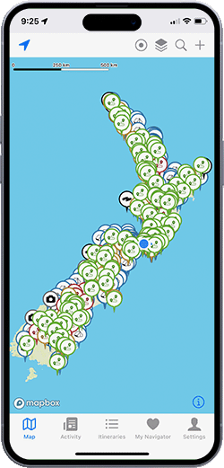
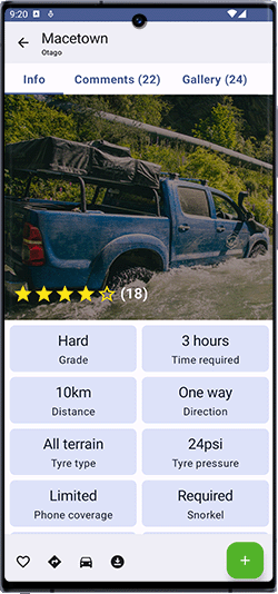
iPhone app screenshot Android app screenshot

Overland Navigator

Offroad adventure app for exploring the best New Zealand has to offer.

4WD routes, campsites, interest points and so much more.

Start exploring for free

Hand holding phone

4,500kms+ of amazing routes
all over the country

100s of campsites
across both islands

The latest info from people
driving the routes

Awesome sights and other
interest points to visit

Find your new favourite spot

With an ever growing list of 4x4 tracks, campsites and interesting things to explore all over New Zealand, no matter where you are, Overland Navigator makes it easy to find cool new spots!

All the details you need

We've built up a collection of routes, including their details and challenges - grading them from gravel backroads to the more gnarly. Take the guess work out of overlanding and know what's coming up next.

No complex GPX files or setups

Forget clunky old GPS devices and tricky GPX files, Overland Navigator is designed to be simple! Download the app, create an account and start exploring in under a minute.

The latest info from explorers like you

We can drive the tracks - but the best updates come from people who are out there exploring right now. With comments and photos you'll know exactly what to expect.

Tides
River flows
Latest forecasts
Plan trips with itineraries

Track interest points
Record your own routes

(iOS only)

Easy search
DOC land, public access overlays

Popular routes

Sample route

Nevis Valley

Otago

6 hours

66 kilometres

Bush rash

None

Tyre pressures

24psi

Snorkel

Recommended

Cellphone coverage

None

Environment

High country

Surface

Gravel

The Nevis Valley is an off-road adventure like no other, offering a journey through one of New Zealand’s most remote and historic landscapes. Known for its vast, rugged terrain, the valley is home to the country’s highest public road, stunning views, and remnants of a bygone gold mining era. It’s an unmissable experience for those seeking a mix of adventure and history.

The route begins (or ends) with a climb onto New Zealand’s highest public road, providing spectacular panoramic views of the surrounding mountains and valleys. From there, the track descends into the expansive Nevis Valley, where you’ll encounter evidence of its rich gold mining past and the sheer resilience of those who once called this remote area home.

The road is closed to motor vehicles annually from the first Monday in June to September 30th. Outside these months, always check for recent weather conditions before heading out. The track is largely unsealed, with a mix of gravel, rocky sections, and muddy patches, particularly in the middle section of the valley.

Elevation

As rated by 22 explorers like you

Get more with Navigator Pro

Unlock the complete track catalogue and advanced features with Navigator Pro.

Navigator Free

$0

per month
  • Popular tracks and campsites around New Zealand
  • Keep track of your favourite spots
  • All comments and reviews
  • Unlimited itineraries
  • Full offline support
  • No ads
  • High resolution topo maps
  • Toggle data layers
  • Extra information to help you explore

Navigator Pro

$7.99

per month
  • Tracks and campsites around New Zealand
  • Keep track of your favourite spots
  • All comments and reviews
  • Unlimited itineraries
  • Full offline support
  • No ads
  • High resolution topo maps
  • Toggle data layers
  • Extra information to help you explore

Sign up for a year and get a month free!

Get in touch

Having issues? Track or campsite info not correct? Have a suggestion? We'd love to hear from you!

Contact us